
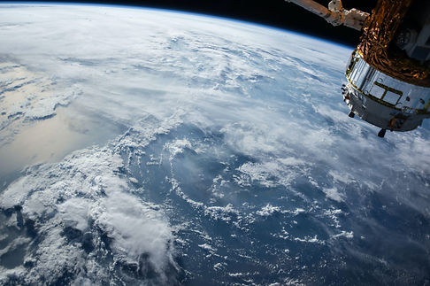
Remote Sensing
We Provide Remote Sensing Services for a wide range of applications
Remote Sensing Solutions
With over 20 years of experience in satellite image processing, XPATIAL Company's Remote Sensing department specializes in providing comprehensive geospatial solutions for various industries. Leveraging the power of artificial intelligence and advanced satellite technologies, our expertise in satellite image analysis, geospatial data processing, and machine learning algorithms enables informed decision-making, resource optimization, and sustainable practices across sectors such as urban planning, environmental monitoring, agriculture, and forestry.
Precision Agriculture
In addition to crop health monitoring, yield prediction, and nutrient management solutions, we also provide services such as irrigation scheduling, pest and disease detection, evapotranspiration estimation, and soil moisture monitoring. These comprehensive agricultural insights help farmers maximize productivity, minimize resource usage, and promote sustainable farming practices.


Water Resource Management
Our tailored solutions encompass drought and flood monitoring, groundwater mapping, irrigation management, and water quality assessment.
Forest Management
We provide forest inventory mapping, deforestation monitoring, and forest health assessment to enable informed decision-making for resource allocation and conservation.


Urban Planning
Our urban sprawl monitoring, land use classification, and transportation planning solutions help city planners optimize resource allocation and improve urban sustainability.
Coastal and Marine Monitoring
We monitor and map coastal and marine environments, including coral reefs, mangroves, and seagrass beds, supporting sustainable management and conservation efforts.


Land Deformation Monitoring
Utilizing multi-resolution satellite imagery and advanced algorithms, we monitor ground subsidence, landslides, and other land deformation phenomena.
Air Quality Monitoring
Utilizing satellite-based data, we provide air quality monitoring solutions to help governments and organizations track pollution levels, identify sources, and implement effective mitigation measures, ultimately promoting public health and environmental safety.

Capabilities
Focusing on innovation, quality, and customer satisfaction, XPATIAL Company's Remote Sensing department is dedicated to delivering cutting-edge geospatial solutions for various applications.
1. Land use and land cover mapping: By utilizing multi-resolution satellite imagery, we provide detailed land use and land cover maps that can be used for urban planning, natural resource management, and environmental monitoring.
2. Vegetation health monitoring: Our medium/high-resolution imagery services allow clients to monitor vegetation health by tracking indices such as NDVI, EVI, SAVI and LAI, as well as target/anomaly detection and classification algorithms. These tools are critical for applications in agriculture, forestry, and biodiversity conservation, allowing for the assessment of crop health, vegetation stress, and changes in land use over time.
3. Crop yield prediction: We help clients predict crop yields using high-resolution aerial imagery, LiDAR data, and medium-resolution satellite imagery to provide detailed information on crop height, biomass, growth, and health.
4. Soil moisture monitoring: Our services include soil moisture mapping using both optical and microwave sensors such as Landsat, Sentinel-2, SMOS, Sentinel-1, and other advanced satellite technologies. This data is valuable for agriculture, drought monitoring, and water resource management.
5. Drought monitoring: By providing regular updates on soil moisture levels using microwave sensors, we help clients predict and mitigate the impacts of drought on agriculture and other industries.
6. Forest inventory: We offer forest biomass and carbon stock estimation using LiDAR data and medium-resolution satellite imagery. This information is essential for sustainable forest management, carbon trading, and climate change mitigation.
7. Flood monitoring: We provide flood extent mapping and damage assessment using high-resolution aerial imagery, LiDAR data, and medium/high-resolution satellite imagery. This information is crucial for disaster response, recovery efforts, and insurance claims.
8. Bushfire monitoring: Our bushfire monitoring services include fire extent mapping, damage assessment, and recovery progress monitoring using high-resolution imagery, LiDAR data, and low/medium-resolution satellite imagery.
9. Urban planning: Our urban planning support services include detailed information on building height, density, and land use, as well as urban growth mapping using high-resolution aerial imagery, LiDAR data, and medium-resolution satellite imagery.
10. Health Risk Assessment: Our Remote sensing data analysis service can be used to identify potential health risks by mapping environmental factors such as air and water pollution, disease vectors, and hazardous waste sites. This information enables public health officials to take preventive measures, allocate resources efficiently, and develop targeted interventions to protect vulnerable populations.
11. Interferometric Synthetic Aperture Radar (InSAR): we provide InSAR services for various applications, including monitoring ground deformation, infrastructure stability, land subsidence, and detecting changes in land surface due to groundwater pumping and mineral extraction. InSAR's accurate measurements are essential for urban planning, infrastructure maintenance, water resource management, and ensuring public safety while minimizing maintenance costs.
12. Coral reef monitoring: We offer coral reef health monitoring and mapping using high and medium spatial resolution imagery like WorldView-3, Landsat, and Sentinel-2. This information is vital for marine conservation and coastal management.
13. Water quality monitoring: We monitor water quality parameters in rivers, lakes, and coastal areas using hyperspectral imagery and multispectral sensors like Landsat and Sentinel-2.
14. Coastal and marine monitoring: We monitor and map coastal and marine environments, including coastal erosion, coral reefs, mangroves, seagrass bed mapping and monitoring and coastal habitat connectivity analysis.
15. Surface water detection and monitoring: We detect and monitor surface water bodies using Landsat, Sentinel-2, and synthetic aperture radar (SAR), providing valuable information for water resource management and disaster response.
16. Topographic mapping: We create high-resolution topographic maps, digital elevation models (DEMs), and 3D terrain models using LiDAR and aerial imagery for infrastructure planning and monitoring, as well as environmental assessments.